
Miami Metrorail map
The full system diagram, plus a PDF you can keep on your phone.
The Metrorail system map
Two lines, 23 stations. Orange and Green share the central section between Earlington Heights and Dadeland South, which is why so much of the map looks like a single line with a branch at the top.
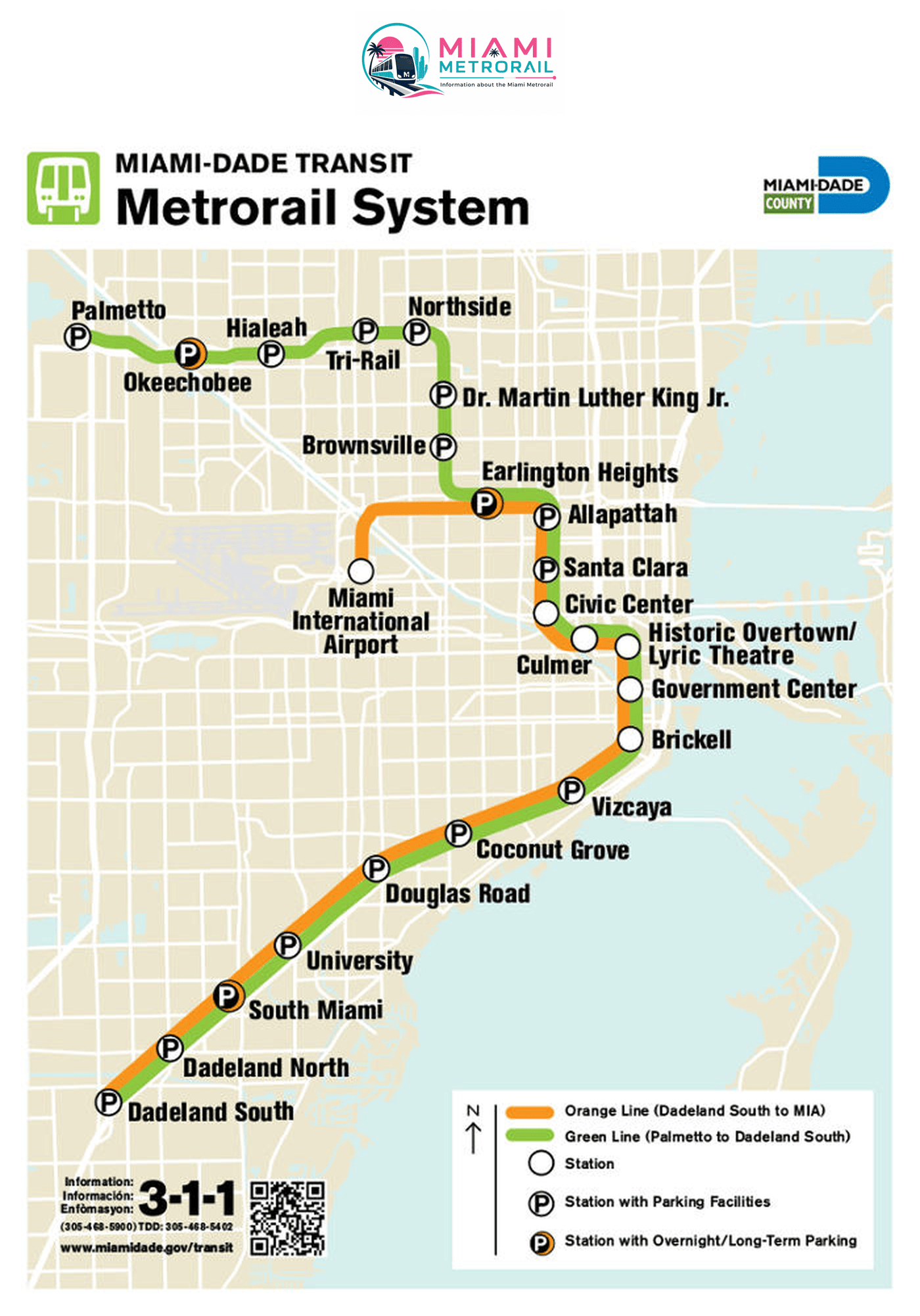
One note on the map. The station printed as Civic Center is now called UHealth/Jackson — Miami-Dade renamed it, and both the operator’s current data feed and the station signs use the new name. Everything else on the map matches.
Miami Metrorail map PDF — download
The same diagram as a vector PDF: it stays sharp however far you zoom in, prints cleanly on one sheet, and works with no signal — which matters on the underground section between Government Center and Brickell.
Metrorail system map · PDF
The official Miami-Dade diagram, vector-sharp at any zoom — keep it on your phone for when there is no signal underground.
Every station, in order
Two lines, 23 stations. They run separately at the north end and share the same track from Earlington Heights south to Dadeland South.
Orange Line branch
1 station of its own
Green Line branch
7 stations of its own
Shared by both lines
15 stations, Earlington Heights to Dadeland South · a train about every 8 minutes on weekdays
Frequently asked questions
23. The Green Line calls at 22 of them and the Orange Line at 16; they share 15, so only Miami International Airport is Orange-only.
At Earlington Heights. North of there the Green Line continues to Brownsville, Northside, Hialeah and Palmetto, while the Orange Line heads west to Miami International Airport.
No. Metrorail stays on the mainland — there is no rail crossing to Miami Beach. From Government Center, Metrobus routes cross the causeway.
Schedules, station data and fares on this page come from Miami-Dade Transit’s published GTFS feed and its official station layer. This is an independent guide and is not operated by Miami-Dade County. Always check the operator’s Metrorail page before you travel.